Boulder Rock

Boulder Rock, located in Midgegooroo National Park, is a spectacular large granite rock formation with several large boulders.
Also a great popular picnic spot!
Looking for more?

Araluen Botanic Park
These much-loved botanic gardens have long been the jewel in Armadale's crown.
Araluen Botanic Park is best known for its tulips which cover the park in carpets of colours during Spring, but the park has much more to offer. With a deep and interesting history, this local gem is an all-year destination.
The hybrid design of the park combines natural bushland with landscaped beds, bridges and buttresses nestled deep within the Brookton valley, a scenic 30-minute drive southeast of Perth.
Explore the park's many trails, which follow winding brooks and lead to showcases of speciality blooms such as heritage climbing roses and some of Western Australia's rarest camellias. Araluen Botanic Park plays host to regular events, such as outdoor concerts and performances and is also a popular wedding venue choice. Whether you grab a bite to eat at on-site eateries, the Roundhouse or Chalet Healy or take your own picnic, there is always something to enjoy at Araluen Botanic Park.
The It's Yates Springtime Tulip Festival takes place annually for approximately six weeks during August and September.
FACILITIES AND FEATURES
14 hectares of landscaped gardens
Heritage climbing roses
Over 230 varieties of camellias
Walk trails
Restaurant and cafe
On-site parking
Picnic areas
Historical and heritage status
OPENING TIMES
18 AUG – 2 OCT - 9.00am to 6.00pm
2 OCT – 18 AUG - 9.00am to 4.00pm
ENTRY FEES
Adult | $15.00 |
*Concession | $10.00 |
Companion Card (2 for 1) | $15.00 |
Child 6-16 years | $8.00 |
Bus Group (20 or More in one vehicle) | $15.00 PP |
Family Pass (2 adults & 3 children) | $45.00 |
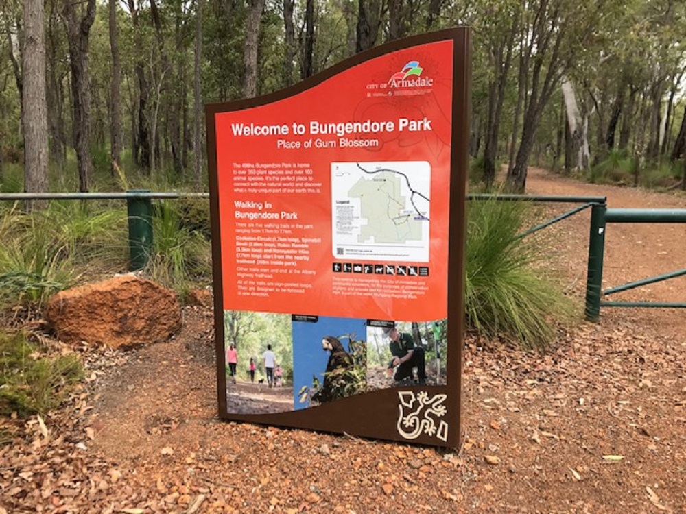
Bungendore Park
Bungendore Park leads through an area of natural Jarrah-Marri bushland. This park has a wide variety of flora and fauna, including endangered species of cockatoo, including Baudin’s, Forest Red-Tailed Black, and Carnaby’s.
Bungendore Park is a natural Jarrah-Marri woodland area that is part of Wungong Regional Park located on the Darling Scarp's border. The park is home to a diverse range of flora and animals, including endangered cockatoo species such as the Baudin's, Forest Red-Tailed Black, and Carnaby's.
The 498ha Bungendore Park Bushland Reserve is home to a wide variety of plants and animals. It's part of the Wungong Regional Park. In fact, its location on the western edge of the Darling Scarp means the park displays a wide range of soils, topography and vegetation types, producing well over 300 different plant species.
Most of the park is open Jarrah-Marri forest with a typical suite of understorey shrubs and orchids. The park also features many blossoms - a fact which helped it to earn its name, which means 'place of the gum blossom' and 'top of a hill' in local Aboriginal language.
Bungendore Park is situated on the edge of the Darling Scarp, with sweeping views to the Swan Coastal Plain. It's located three kilometres south-east of Armadale and can be accessed from Admiral Road. Walkers can set out on marked trails located throughout the reserve.
A committee of Council, known as the Bungendore Park Management Committee, assists in the management of the area. type: asset-hyperlink id: 2spD3ctqZGZEXw2rZdS1L9also helps guide management activities.
The Bungendore Park Environmental Group, a Committee of volunteers, provides oversight on the management of the reserve.
Difficulty
Grade 2 Bush Walk - No prior bushwalking experience required. The surface of the track is hardened or compacted, and it may include a modest incline portion or sections, as well as occasional steps. Walks of no more than 10 kilometres. This is a good option for families with young children.
Location
There are two main access points to Bungendore Park – one from Dryandra Drive off Albany Highway east of Armadale, the other from Admiral Road near the Southern Hills Christian College entrance. Vehicle access to within the park is restricted to only authorised vehicles.
type: asset-hyperlink id: 56GbEHggNhfp4Vi88HK48e

Canning Dam Reservoir and Recreation Area
Canning Dam is one of the important reservoirs sitting along the protected water catchment areas along the Darling Scarp.
ABOUT
Located on the Canning River (Djarrlgarro Beelier) approximately 33km from Perth (Boorloo), this dam combines scenic beauty, an established picnic area for the whole family and modern playground equipment for kids. It also tells of a fascinating Western Australian history of one of our most important reservoirs and supply of Perth's drinking water.
There are several trails to explore in the vicinity of Canning Dam, designed to guide you to historical features such as the old water contour channel and the stilling chamber. You can also take a stroll across the dam wall and enjoy the views from lookouts at either end.
Please note: no fishing, marroning or contact with the water body is permitted however visitors are welcome to enjoy the recreational facilities provided nearby.
FACILITIES & FEATURES
Picnic areas with bbq free facilities
Toilets (wheelchair accessible)
On-site parking
Walk trails (signposted)
Historical sites
Wildlife spotting (particularly in the morning)
OPENING TIMES
Canning Dam is open every day of the week until 6pm (5pm from May to October).

Churchmans Brook Dam and Recreational Area
With five picnic spots to choose from, Churchman's Brook Dam is a great spot for a day out in the hills.
ABOUT
Churchman Brook Dam was built in the 1920s and provided a substantial portion of Perth's water supply until 1937. Later Wungong and Canning Dams were built to accommodate extra supplies for Perth's growing population. The dam was registered on the City of Armadale's heritage list in December 2008.
With a range of grassed areas, picnic benches, playground equipment, toilets and free gas barbeques, this is an ideal spot to enjoy and explore the Perth Hills.
FACILITIES AND FEATURES
Picnic areas
Toilets
Barbecues
Playground
Toilets
Parking
OPENING HOURS
December – April hours: Every day until 6pm.
May – October hours: Every day until 5pm.

Lloyd Hughes Park
Lloyd Hughes Park (the Park) is a 17.7 hectare A-class reserve managed by the City of Armadale in the Darling Scarp foothills, Kelmscott.
Lloyd Hughes Park on Martin Street, Kelmscott, is approximately 17ha in size. A watercourse (tributary to the Canning River) runs through the reserve, which contains bushland in good condition. The Park is bounded by Martin Street, Marmion Street, Canning Mills Road, and abuts Banyowla Regional Park to the north. The Park straddles the boundary between the Ridge Hill Shelf and the Darling Scarp soil types.
The vegetation is dominated by Marri woodland on the lower slopes, and Wandoo woodland on the upper reaches of the reserve. Weeds threaten areas of the bushland (probably resulting from past disturbances such as rubbish dumping). These weeds include Ehrharta calycina (veldt grass), Avena fatua (wild oat), Watsonia Sp., and Eragrostis curvulata (African Love Grass).
Lloyd Hughes Park (the Park) is a 17.7 hectare A-class reserve managed by the City of Armadale in the Darling Scarp foothills, Kelmscott.
The Park is situated on the interface that exists between the Ridge Hill Shelf and the Darling Scarp. A seasonal creek runs through the park to join the Canning River.
The park is characterised by Marri and Jarrah woodland, in addition to Flooded Gum woodland along the creek line.
Areas within the park were once used to mine gold and slate.
The park has significant conservation value due to the transitional nature of the vegetation as the area traverses the Swan Coastal Plain and Darling Scarp. The bushland has a diverse ecosystem that provides a habitat for native fauna and wildflowers while also providing residents with a vital recreational area.
The Friends of Lloyd Hughes contribute to the conservation of this area. The Friends of Lloyd Hughes is a community-based group that assists the City with on-ground management. This passionate group of volunteers works on revegetation, weed control and dieback management within the park
Walk Trail Difficulty: The Park features two walk trails: Prickly Moses and Yam Trail. A QR Code that links to a trail map can be found on the signs at the Martin Street entrance. The walk trails are considered 'Grade 2', with some bushwalking experience recommended. On-leash dog walking is permitted.
Location
Main entrance Martin Street, Kelmscott. The Park is bounded by Martin St, Marmion St, Canning Mills Rd, and abuts Banyowla Regional Park to the north.
type: asset-hyperlink id: 1m2IychkTjbg6ofIBOGcU7

Helena National Park
Helena National Park in the Perth Hills offers scenic bushwalks through jarrah and wandoo forests. Visit Mount Dale for stunning views and enjoy a peaceful break at the nearby picnic area with tables, toilets, and forest vistas.

Minnawarra Park - Orchard Ave, Armadale
The parklands surrounding the Historic Precinct provide a great spot for a picnic with a large lake, paved and shaded picnic areas, expansive lawns and a variety of water birds to keep you company.
Minnawarra Park has been the heart of the City of Armadale since the land was acquired in 1958. Since then it's been the site of events, weddings, walks, celebrations and picnics.
Minnawarra Park is located just next to the Minnawarra Historic Precinct, which houses Minnawarra Chapel and History House Museum.
A beautiful place to enjoy a quiet moment or read a book in this tranquil spot.
The Park has a paved, even path that follows the natural contours of the park and connects with the Minnawarra Historic Precinct to the park gazebo, bridge.

Rediscover Armadale Heritage Tree Walks
Take a journey through the City centre and discover 21 trees of historical and botanical significance. The walk may be taken in sections, or in its entirety (approximate 5km loop), as marked on the map.
Explore the region on foot on a self-guided walking tour showcasing Armadale's botanic beauty. In 1988, to celebrate Australia's bicentennial anniversary of settlement, a 4.5km walk through Armadale's city centre was designed, along which 22 trees of significant were marked.
In 2015, these trees were rediscovered and several more identified with 29 trees forming the trail today. The gentle walk meanders through Armadale's streets and parks, travelling past beautiful trees of historic, botanic and cultural importance - some well over 100 years old!
The walk may be taken in sections, or in its entirety (approximate 5km loop), as marked on the map. The walk may be started at any point however the numbering and following instructions start at the Armadale Visitors’ Centre at the intersection of Jull St and Hughes Rd.
To find out more download thetype: asset-hyperlink id: 52qysR1GN6VwuOIIFQOvBz.
Collect your map from the Perth Hills Armadale Visitor Centre, where the trail begins.

Roley Pools Heritage Walk Trail
Part of the Six Seasons Trails - Djilba (August - September)
Roley Pools Heritage Trails, located along the banks of the Djarlgarro Beelier (Canning River) in Roleystone, is a picturesque area with many small waterfalls over granite rocks along the steep-sided valley. There is a natural pool that is accessed by steps from Collins Road. This is the original Roleystone swimming hole, and was a popular swimming place for Roleystone residents from the early 1900's.
The reserve’s bushland is diverse, featuring Flooded Gum, Wandoo, and Marri trees. The river supports many native animals, birds and fish including Quenda, Rakali, Black Cockatoos, and Freshwater Cobbler.
Roleybushcare is an environmental community group that is focused on maintaining and protecting the bushland around the Roleystone and Karragullen areas.
The walking trail facilities at Roley Pools have recently been upgraded with new trail markers and information signage. Scan the QR codes on the new signs and learn about Noongar culture and landcare. type: asset-hyperlink id: 3rMa5ThRShCSNFIrDMyuss
There are four walk trails:
Boardwalk Trail - Starting on the south side of the river from Soldier Road bridge and finishing at Thompson Road
Nature's Spa -
Coming off the Boardwalk Trail on the south side of the river and going down to the river.
Roley Pools Walk Trail -
Starting from the north side of the river in the upper car park near Soldiers Road bridge and going along the north side to Roley Pool itself where the steps up the hill lead to Collins Road.
Heritage Walk Trail -
Starting at Thompson Road and finishing at Heritage Drive on the south side of the river.
Difficulty
Grade 3 – Some bushwalking experience required. On leash dog walking is permitted.